


Few volunteer activities in the Czech Republic have as long and enduring a tradition as hiking and the associated trail marking. Navigating them is not complicated; you just need to understand them and set off on your journey. Who manages the hiking trails? And what is the situation like abroad?
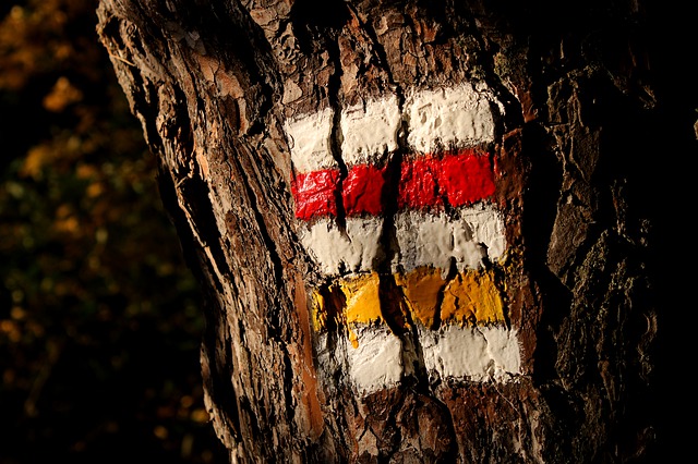
When people talk about hiking markers, most imagine three stripes that indicate the exact direction of the route. Sometimes they peek out inconspicuously from the bushes and it takes a while to find them, other times they end up in a stove along with the tree they were painted on, but mostly they are reliable servants on the way to the summit.
A respectable history of the Czech Tourists Club
The Czech Tourists Club (KČT) began marking trails in nature as early as 1888. It was founded by a patriotic group around Vojta Náprstek, which marked the first route from Štěchovice to Svatojánské boudy on May 11, 1889. However, that was flooded by the Štěchovice water reservoir, so the first preserved route is the one from Beroun to Karlštejn, which is now part of trail number 0001.
It is said that the Czech Republic has the densest network of marked hiking trails, which are regularly maintained and cared for by the KČT. Today, it brings together about 33,000 members - volunteers who currently look after 40,000 kilometers of trails or tourist hostels. Markers must be at least 250 meters apart, but adhering to such rules is hindered by tree felling or, for example, changes in land ownership.
Fancy a hike or a horseback ride?
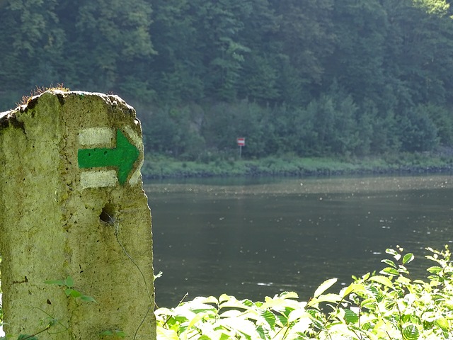
Pedestrian routes are the most popular and widely used by tourists. The markers consist of three stripes, with the middle one indicating the color of the route and the outer white ones serving to make the marker visible. In sharp turns, an arrow is added, the end of the path is marked by a colored square on a white field, and there are also specific markers for ruins, springs, wells, summits, or nature trails. At regular intervals, there are also tourist signs and directional signposts.
In winter, skiing routes are used. These markers are the same as for hiking, but instead of white stripes and signs, a different color is used - orange. Cycling trails are either road-based with a yellow background color or off-road, identical to hiking ones but also on a yellow background. Road cycling markers include a bicycle symbol, route number, and sometimes the destination and distance. Road routes are often long-distance, in which case they have a one or two-digit number, and sometimes their own logo.
In recent years, routes for horseback riders, so-called equestrian trails, and trails for wheelchair users have been spreading. In 2008, the KČT launched a collection for the disabled and uses the raised money to maintain and establish routes for those whose legs do not serve them. It even distinguishes three types of wheelchair routes, and their classification depends on the level of the disabled person's ability.
On foot from Šumava to Greece
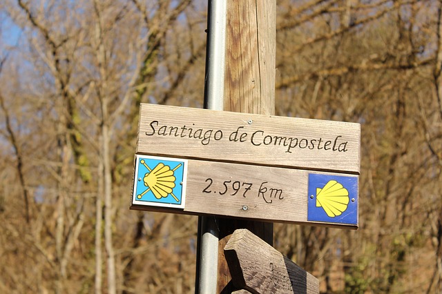
There are three long-distance international hiking trails in the Czech Republic. E3 from Santiago de Compostela to Pomezí runs through our territory via the Ore Mountains, Lusatian Mountains, Giant Mountains, the Polish Owl Mountains, returns to Kralický Sněžník, to the Jeseníky Mountains, to Slovakia, and ends at Cape Emine on the Bulgarian shores of the Black Sea.
E6 lines the shores of the Baltic Sea near Stockholm, crosses Mariánské Lázně, Šumava, Austria, the Balkans, and ends in Dikella, Greece. And E10 starts at Cape Arkona on Rügen, continues through Varnsdorf in Germany, the Central Bohemian Uplands, Prague, České Budějovice, and ends in Bolzano, Italy.
The Banat region is unmistakable
The Czech marking system is also an inspiration abroad. "We are working in Transcarpathian Ukraine, the Caucasus, Crimea, Macedonia, or Serbia. In Eastern Europe, unlike mass tourism, hiking is sustainable and the infrastructure also helps the locals," said Kristýna Studená from the Brontosaurus movement in an interview for Czech Television.
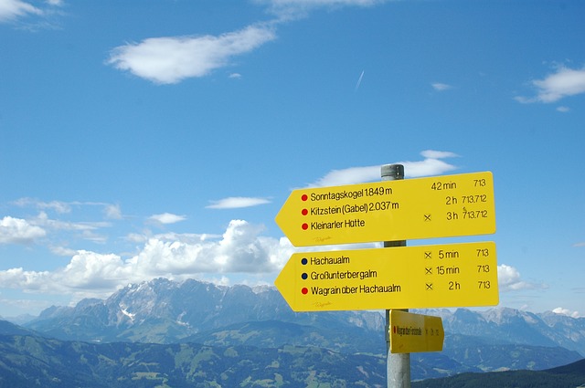
They have equally sophisticated trails in the Romanian Banat or in Croatia. A trail with Czech markers also exists in Bataypora, Brazil, where it was founded by Jan Antonín Baťa. Abroad, routes are usually defined more by hours than by kilometers, but in some places, you will find a combination of both.
"Painting markers might look simple, but the whole methodology is quite demanding. It includes a total of 12 volumes of scripts, i.e., several hundred pages. As a marker who paints, you have to master four of them and also pass exams," described Karel Markvart from the Czech Tourists Club for the 100+1 magazine. It may seem like demanding volunteering, but thanks to you, someone might experience the best travel moments of their life.
TIP: If you like planning trip routes and do not own printed maps, you can easily search for hiking trails using the route planner on the KČT website or directly on the mapy.cz portal.
Photo source: www.pixabay.com


